
Crafting a Permanent URL Architecture for Alpine Cartography: The Biwak.info Data Challenge

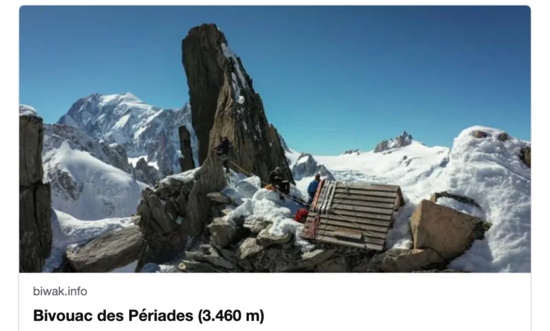
The digital mapping of Alpine geography presents a unique set of challenges for developers, particularly when attempting to bridge the gap between volatile OpenStreetMap data and the need for persistent, user-friendly web identifiers. For the operators of Biwak.info, a specialized mapping platform dedicated to Alpine huts, bivouacs, and mountain peaks, the transition from hash-based linking to a stable URL structure—represented by the format biwak.info/p/name—has necessitated the creation of a sophisticated, registry-backed slugging system. This technical evolution addresses the inherent instability of geographic databases while ensuring that shared links remain functional even as the underlying data evolves.
The Problem of Non-Unique Geographic Identifiers
OpenStreetMap (OSM) serves as the foundational data source for Biwak.info, providing a comprehensive catalog of 42,866 distinct locations, including 9,429 shelters and 33,437 named peaks. While these entities are easily indexed within a database, translating their names into human-readable URLs, or "slugs," poses a significant naming conflict issue. In Alpine regions, nomenclature is rarely unique; local histories and repetitive naming conventions mean that dozens of disparate locations often share identical titles.
For instance, common names like "Jagdhütte," "Schwarzkogel," and "Rosskopf" appear dozens of times across the map. A simple slugification process—transforming "Oberaletschhütte" to "oberaletschhuette" or "Rifugio Città di Busto" to "rifugio-citta-di-busto"—is insufficient because it fails to distinguish between the various entities sharing those names. Without a robust disambiguation strategy, a user attempting to link to a specific mountain hut might inadvertently direct a reader to an entirely different, unrelated location.
Chronology of the URL Implementation
The development of the Biwak.info URL system followed a multi-stage process designed to balance readability with technical longevity. Initially, the site relied on hash-based navigation, which required the application to perform an exact name match or force a search prompt when ambiguity arose. Recognizing that this created friction for users sharing content on social platforms and chat applications, the team prioritized the development of persistent URLs.
The project began by assessing the failure rates of various slugging strategies. Initial measurements revealed that using the base name alone resulted in 2,181 shared slugs, affecting over 15% of the total dataset. Incorporating country-level data proved largely ineffective, as the majority of name duplicates occurred within national borders. The introduction of regional identifiers reduced the collision rate significantly, but it was not until the addition of elevation data that the number of ambiguous entries dropped to less than 1%.
However, the final hurdle remained the 4,311 locations in the OSM database that lack elevation metadata. To resolve this, the development team implemented a tiered generator that prioritizes the shortest possible unique slug, falling back to a combination of name, region, elevation, and finally, the immutable OpenStreetMap ID, which functions as a last-resort identifier for otherwise indistinguishable sites.
Data Methodology and Geographic Context
To ensure that the "region" component of the URL is recognizable to the average user, the developers integrated administrative boundary data from Natural Earth. This dataset was carefully curated to reflect the political and cultural realities of the Alpine region. The system utilizes specific administrative units: Bundesländer in Austria and Germany, Cantons in Switzerland, Departments in France, and statistical regions in Slovenia.
The mapping process employs a point-in-polygon lookup mechanism utilizing the Shapely library. This approach allows the system to determine the region of any given coordinate. In instances where a hut is situated precisely on a border or near a shoreline—where simplified boundaries might cause a point to fall outside a polygon—the system defaults to the nearest neighboring region. This ensures that every location is assigned a descriptive, user-friendly identifier that adds context to the URL itself, such as "Biwak – Haute-Savoie, France."
The Slug Registry: Ensuring Link Permanence
The most critical innovation in the Biwak.info architecture is the implementation of a static "slug registry." This JSON-based file, committed to the project’s version control system, acts as a historical record of every URL issued. By maintaining this registry, the system ensures that if a new location is added to OpenStreetMap that would theoretically "usurp" an existing name, the original URL remains anchored to its original target.
The registry operates under three strict governing rules:
- It preserves existing assignments to prevent link rot.
- It reserves slugs for deleted locations to prevent future ambiguity.
- It provides a readable, audit-able trail for developers to track changes via version control diffs.
This registry approach also provides a recovery mechanism. Should a location be removed from OpenStreetMap, its slug is not repurposed; instead, the system initiates a search for the historical name, maintaining the integrity of the user’s navigational experience. This "never-forget" policy is essential for maintaining the long-term utility of the map as a reference tool.
Broader Implications for Geographic Information Systems
The technical approach adopted by Biwak.info highlights a broader trend in Geographic Information Systems (GIS): the move toward human-centric, persistent identifiers for open-source data. By abstracting the complexity of database IDs into semantic, regionalized slugs, the platform lowers the barrier to entry for users who are not GIS professionals.
Furthermore, the integration of fallback mechanisms—such as the ability to resolve URLs ending in a direct OSM ID even if the descriptive portion is outdated—serves as a model for data resilience. Experts in the field of cartography suggest that as the volume of open-source geographic data continues to grow, the ability to maintain "canonical" links will become increasingly important for academic research, emergency response services, and the tourism industry.
While the current system faces limitations—specifically regarding the reliance on OSM data quality and the necessity of constant manual or semi-automated updates to the registry—it represents a significant advancement over standard database query results. The success of this implementation suggests that for platforms relying on community-sourced data, the investment in a stable, version-controlled link registry is not merely a convenience, but a fundamental requirement for building a reliable, long-term digital resource. As the platform looks toward future updates, the emphasis will likely remain on refining these automated processes, ensuring that the Alpine landscape remains accessible to all, regardless of how often the underlying digital map evolves.